

Shaded Bathymetry Map Showing Bedrock Popups


Mapping Solutions for a Changing World
Tekmap Consulting is a Canadian company committed to providing custom mapping and data solutions that meet our clients' needs. In business since 1994, we provide services in Marine Geomatics, 3-D Visualization, Software Development, Web Mapping, and Photogrammetry.


Featured News

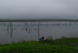
Over a two day period in June 2011, Tekmap Consulting used the SHLS to map a shallow tailings and polishing pond and pit. Depths in the tailings and polishing ponds ranged from < 1m to 4m. Depths in the pit ranged from < 1m to 51m. In total, over 200,000 soundings were collected using the SHLS.

 Tekmap Consulting is pleased to announce that it now offers two additional services,